
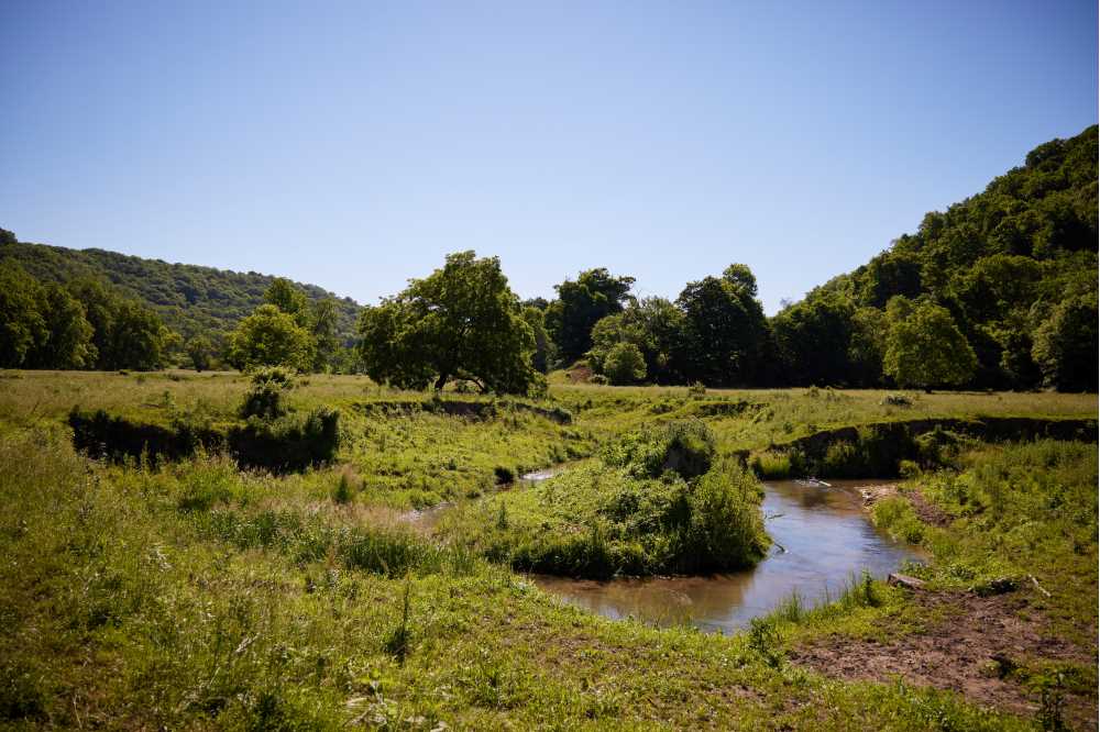
WAUZEKA, Wis. — A two-mile stretch of Plum Creek in rural Crawford County is being transported 170 years into the past, thanks to a research team from UW-La Crosse.
Junior Travis Key and faculty mentors Colin Belby and John Kelly are using drone imagery, soil samples and geographic information system software to determine how the creek and surrounding countryside have changed since European-American settlement in the 1850s.
The Mississippi Valley Conservancy, which recently acquired the 1,600-acre property near Wauzeka, will use the information to restore the landscape to its natural state.
“Over the years, farming practices led to more and more sediment building up along the creek, which cut the stream off from the floodplain,” explains Key, a geography major. “The ultimate goal is for the Mississippi Valley Conservancy to reconnect the river to its floodplain so it will be like it was nearly 200 years ago.”
On a sunny summer morning, the trio parked their cars along the quiet country road, slung heavy packs over their shoulders and set off along the creek.
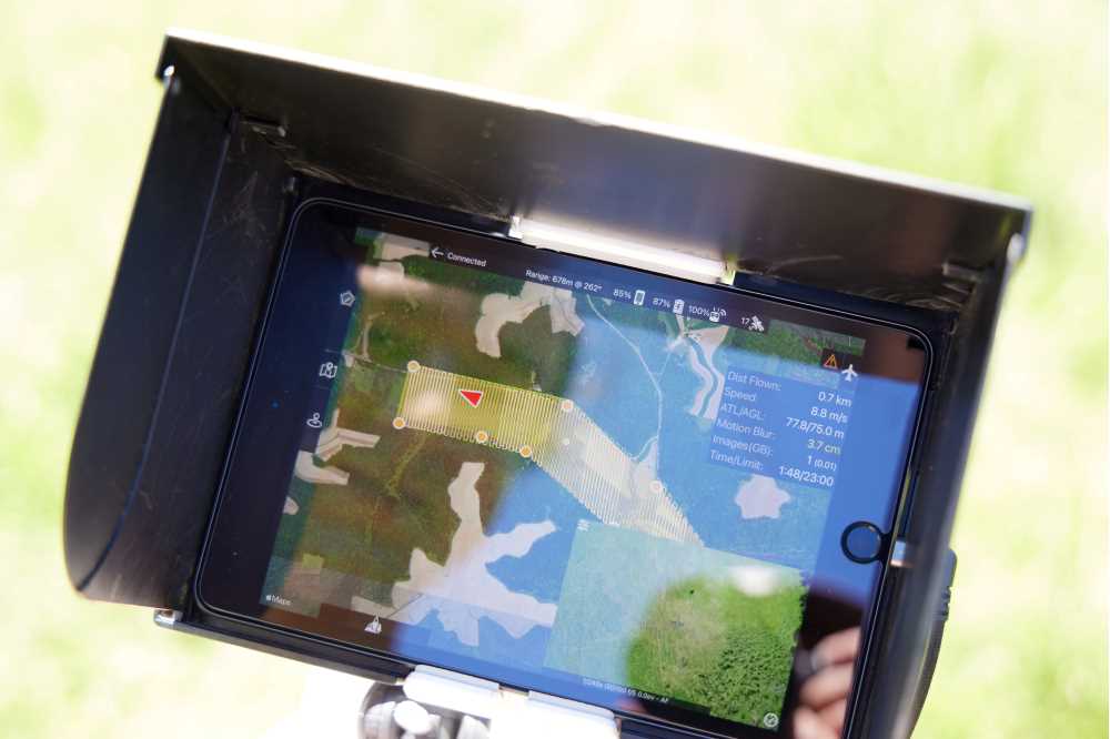
The first order of business was placing markers at surveyed coordinates on the banks. This allows the team to create aerial imagery with centimeter-level accuracy, and to match that imagery to historical aerial photos of the property.
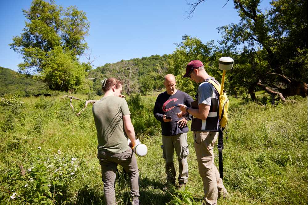
Once the creek was properly marked, Belby sent the drone buzzing on an automated course about 350 feet above the ground.
Then the team used an auger to drill into the soil and extract a foot’s worth of sediment. Additional samples taken deeper in the Earth will shed light on how the landscape has evolved.
“We’re looking for the point where it transitions from light brown soil to dark, almost black soil,” Belby explains. “Dark soil is an indication of higher levels of organic material, which is what you would have had pre-European settlement. We don’t know how deep we’ll have to dig. It could be 10 feet or more.”
Once the soil samples and drone photography are complete, the team will return to the lab and document the land’s changing geography.
Turning the dial back 170 years, they say, will have a major positive impact on the local ecosystem.
“It will allow the river to breathe a little more and turn some of this land into more permanent wetlands,” notes Kelly, who’s on the Mississippi Valley Conservancy Board. “You’ll end up with a healthier and more complex ecosystem resembling pre-settlement times.”
Key, who recently changed his major to geography, says the chance to work in the field alongside Belby and Kelly is a major boost to his college experience. It also underscores the robust undergraduate research offerings at UWL.
While geography students at other universities may not experience field work until late in their program, Key was able to get ahead through the Nick & Yonok Zeller Dean’s Distinguished Fellowship in Land Conservation.
UWL’s Dean’s Distinguished Fellowship program, funded through the UWL Foundation, supports collaborative research between undergraduates and faculty members. Students receive a $5,000 stipend, along with $500 to cover travel and equipment costs.
“My original plan was to work at Kwik Trip this summer,” Key says. “Because of the Dean’s Distinguished Fellowship and the stipend, I get all these new experiences, and I don’t have to work full time.”
The Plum Creek Conservation Area is an ideal place to teach and promote conservation.
The property includes over five and a half miles of frontage along the west bank of the Kickapoo River and over two miles along Plum Creek. Nearby, the nearly 2,000-acre Kickapoo Wildlife Area-Wauzeka Unit supports one of the highest concentrations of rare forest-interior breeding birds in southwestern Wisconsin.
The Mississippi Valley Conservancy was able to purchase the property thanks to a sizable gift from an anonymous donor.
Belby and Kelly say it’s key for students to get hands-on experience with conservation projects, as they are a critical component to many careers related to geography.
In some cases, UWL student researchers use the same equipment and the same software they’ll be expected to use as professionals.
Whatever Key does with his geography degree, his experience at Plum Creek will leave him well prepared.
“Overall, this has been a great learning experience for me, especially since I’m still early in the program,” Key says. “It’s a really cool project to be a part of.”
Written by UW-La Crosse University Communications
Link to original story: https://www.uwlax.edu/news/posts/river-revival/