A Wisconsin business owner is investing in the University of Wisconsin-Eau Claire because its graduates have the hard-to-find geospatial technology skills that he needs to grow his industry.
“In the last two years, we’ve helped at least five students from UW-Eau Claire land jobs immediately after graduation specifically because of their experience with unmanned aircraft systems geospatial data,” said Peter A. Menet, president and CEO of Milwaukee-based Menet Aero. “This is an up-and-coming market. Having people enter the workforce who are intimately familiar with the potential and the limitations of the technology is key to UAS becoming a mainstream solution.”
To help ensure that UW-Eau Claire students continue to gain the knowledge and skills his clients need, Menet recently donated a high-end drone to the geography department.
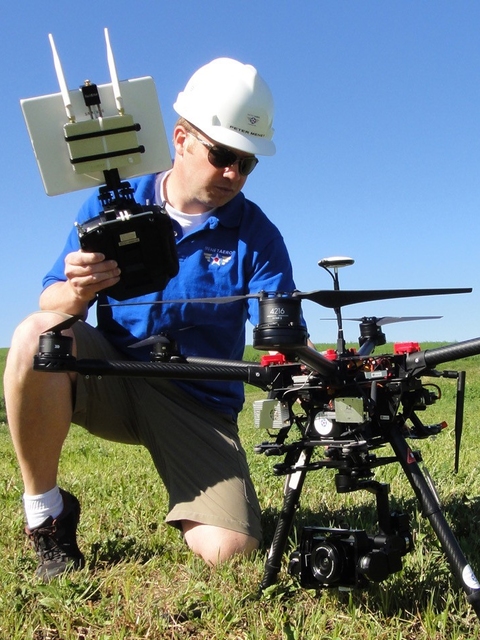
The university’s newest UAS — a FireFly6 Pro manufactured by BirdEyeView Aerobotics — brings the geography department’s UAS fleet to seven drones of various models.
The FireFly6 Pro is a revolutionary aircraft that is able to take off and land vertically like a helicopter but flies through the air like an airplane.
Companies like Google and Amazon are experimenting with the technology, known as vertical take-off and landing, Menet said, noting that it is a perfect aircraft for small- to medium-size aerial mapping applications.
“This addition means our students will have experience with another platform and an even more diverse array of aircraft,” said Dr. Joseph Hupy, associate professor of geography. “Our students definitely have an edge. Many universities have one drone but our students will graduate with an understanding of different drones that are good for different things.”
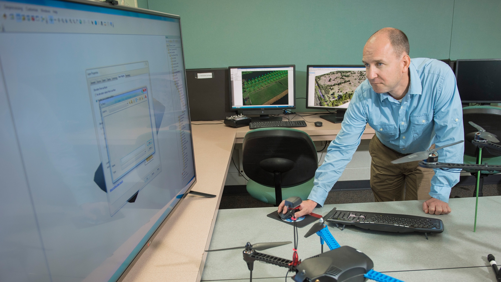
UAS, commonly referred to as drones, have the potential to solve geospatial problems in ways never before imagined. The rapid development of UAS is possible as technology mounted to the devices has become lighter, smaller and less expensive.
Interest in UAS has soared as their uses are considered for everything from agriculture and forestry management, to insurance assessments, and search and rescue missions.
Having an understanding of how to use and how to fly the varied platforms gives Blugolds a huge advantage when looking for jobs because they bring with them the ability to process data and generate data from multiple sensors, Hupy said.
“With seven drones — each with different capability and different data sets — we don’t have enough hours in the day to teach it all in a single class,” Hupy said. “I now mix a lot of work with drones into different classes, including two field methods classes.”
Collaborating with a private business like Menet Aero is good for both the business and the students, Hupy and Menet said.
When UW-Eau Claire began working with Menet Aero two years ago, it was one of a few companies in Wisconsin with FAA permission to operate UAS for nonrecreational purposes, and one of few to provide UAS as a service to other companies.
At the same time, UW-Eau Claire was doing things with geospatial technologies that no other university was doing, Menet said.
“UW-Eau Claire has the only university UAS program that we know of that specializes in the geospatial data derived from the UAS versus the far more common engineering hardware and software focus,” Menet said. “This created a perfect partnership where Menet Aero showed UWEC students how to professionally and legally acquire UAS data and, in turn, we have collectively gained an enormous amount of insight into collection techniques, quality control and enhanced post-processing analysis.”
Since UAS technology is advancing at a pace that surpasses mobile phones, providing UW-Eau Claire with newer aircraft is one way to ensure that the partnership continues to benefit the students and his business, Menet said.
“A large portion of the university’s UAS equipment is already two to three generations old,” Menet said. “We wanted to make an investment in the UWEC students and geography department who have given us so much knowledge in return.”
Menet Aero — and many other businesses — will be looking to UW-Eau Claire graduates to help them make the most of new geospatial technologies as they become available, Menet said.
That means Blugolds will continue to be high demand, he said.
“Menet Aero’s work with UWEC is not to teach UAS theory,” Menet said. “It is focused on real-world applications, solving real-world problems. When you can walk out of college and into a company with high-demand knowledge and experience that no one else has, you are not only guaranteed a job, you’re guaranteed job security.”
Students also are embracing — and appreciating — the opportunities they have at UW-Eau Claire, Hupy said.
“As my drone class was wrapping things up in the field this semester, I heard students saying, ‘Wow, when I took this class I thought it was going to be only about flying drones; what’s even more impressive is what you can do with the data they gather,’” Hupy said.
“This is not an engineering program. We are not building these platforms, but students are learning how to gather and use the information in ways that will help businesses earn their money.”
In addition to providing businesses with employees who meet their current and future needs, Hupy also wants UW-Eau Claire to become a UAS training facility for business and industry.
This summer, he will offer a drone workshop to help area business people and community members better understand GIS software and the ways it can enhance their businesses.
“We will fly the drones but also take them into the lab to show them how to process and do stuff with the GIS software,” Hupy said. “We want them to understand the technology and how it can be used.”
Hupy said he then hopes to begin a national training program in the next couple of years.
“Companies are seeing our potential,” Hupy said. “There is a lot of momentum building.”